Mainly what I would like to see is a much better mobile client/browser.
Main differences between how I store data and Accutracking stores data.
I merge together "duplicate locations" (basically anything submitted within .05 miles + the accuracy value taken from the GPS reading from the last point submitted) as a count. Right now I submit a point every ~3 minutes, temporarily a stop is defined as point with a count of 3 or more.
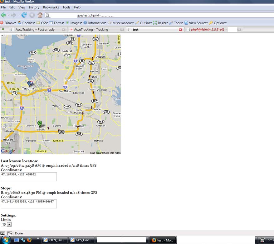
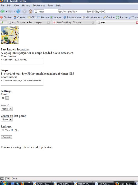
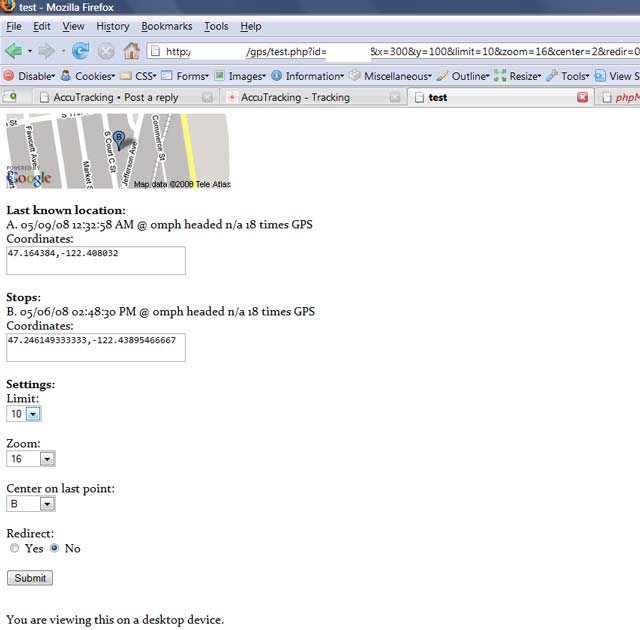
My page uses the WURFL database to determine the size of the mobile screen. In the screenshots, it recognizes a desktop viewer and uses the google maps maximum static size of 500x500. In the future desktop users would obviously get the fully interactive map, but this was a test of making a mobile page. Size of the map can also be forced using the URL GET variables x and y.
Things to note:
[*]The coordinates are in a <textbox> this makes them very easy to copy/paste in to google maps from my blackberry if I want to navigate or get directions to the point.
[*]You dont need a magnifying glass to read the map on a blackberry curve with a decent size screen, the map automatically fills the screen, you can zoom
[*]You can pick any of your stops, center on it, and zoom in to any level, all VERY easy from a mobile browser.
[*]The redirect option instead of showing you this screen, it simply forwards you to the actual static google image allowing you to zoom in w/ the blackberry (you could also go in to select mode highlight the image and copy the url and paste it, using redir=1 is much easier)
[*]I have not implemented moving around the map using arrows (see the static mobile google maps, they do a great job of this)
Screenshots of what i have done:
Sorry for the poor quality, trying to make the sizes smaller.
Tell me what you think, are there any plans to implement something similar?
The Yahoo static maps suck imho.
Mainly what I would like to see is a much better mobile client/browser.
Main differences between how I store data and Accutracking stores data.
I merge together "duplicate locations" (basically anything submitted within .05 miles + the accuracy value taken from the GPS reading from the last point submitted) as a count. Right now I submit a point every ~3 minutes, temporarily a stop is defined as point with a count of 3 or more.
My page uses the WURFL database to determine the size of the mobile screen. In the screenshots, it recognizes a desktop viewer and uses the google maps maximum static size of 500x500. In the future desktop users would obviously get the fully interactive map, but this was a test of making a mobile page. Size of the map can also be forced using the URL GET variables x and y.
Things to note:
[*]The coordinates are in a <textbox> this makes them very easy to copy/paste in to google maps from my blackberry if I want to navigate or get directions to the point.
[*]You dont need a magnifying glass to read the map on a blackberry curve with a decent size screen, the map automatically fills the screen, you can zoom
[*]You can pick any of your stops, center on it, and zoom in to any level, all VERY easy from a mobile browser.
[*]The redirect option instead of showing you this screen, it simply forwards you to the actual static google image allowing you to zoom in w/ the blackberry (you could also go in to select mode highlight the image and copy the url and paste it, using redir=1 is much easier)
[*]I have not implemented moving around the map using arrows (see the static mobile google maps, they do a great job of this)
Screenshots of what i have done:
Sorry for the poor quality, trying to make the sizes smaller.
[img]http://tazeat.com/misc/gps/ss/1.jpg[/img]
[img]http://tazeat.com/misc/gps/ss/2.jpg[/img]
[img]http://tazeat.com/misc/gps/ss/3.jpg[/img]
Tell me what you think, are there any plans to implement something similar?
The Yahoo static maps suck imho.